If you’re interested in mapping caves, you’re in the right place. Cave surveys are important to understand how a cave relates to the surface, and of course, it’s just fun to do. Whether you want to contribute to science or simply want to show off your drawing skills, cave mapping is a great way to learn more and help others. But what stuff do you need?
What do I need for cave mapping? You need equipment to measure the cave, and a way to record the data. The instruments you need are a compass, clinometer, measuring instrument, and notebook. Generally, a survey takes two people, although it can be done alone – but it’s slow.
In this article, I first explain quickly how a survey works, and what equipment you need to draw up your first map (skip to the equipment right away).
To map a cave, you first need to find one. Then, you do a survey.
If you’re not sure how to find new caves yourself and want to know how it’s done, I’ve got your back. I’ve already written an article on how to do it. You can start finding caves here.
How Does a Cave Survey Work?
A cave survey is generally done by a team of at least two people: a surveyor and a draftsman. The surveyor measures, the draftsman takes notes. Then the surveyor measures some more and the draftsman scribbles some more. It can take some time to get into the rhythm, but once it’s set, their cooperation will speed up the entire survey a lot.
The goal of a cave survey is to collect as much information as possible on the cave. This is called in-cave data collection. The more information, the better the map will be. The accuracy of the final map is determined by the amount of data collected during the survey. A proper cave survey can tell us a lot about the hydrology of the cave, and the way it relates to the surface and other systems.
After the survey, all in-cave notes and sketches will be handed over to a cartographer, or the draftsman sets himself/herself to work. You draw the definitive map after the survey, or even after multiple surveys if more information is required.
I’ve previously written a short guide on how to read a cave map. You can read it here.
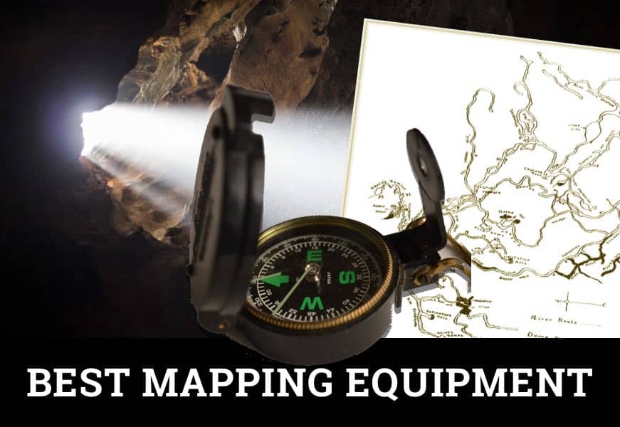
Dry Cave Surveying Equipment
So what items will you need for a survey and mapping? Surveying equipment is pretty straightforward I think – you use some classic, battle-tested pathfinder’s tools:
- Compass for measuring horizontal angles
- Clinometer for measuring vertical angles and heights
- Tape measure or Range Finder for measuring distances
- Hard-cover notebook – Tip: if you’d use the small ones, you didn’t just lose years of data after dropping it in a pool of mud. Even better: use waterproof paper and pen.
- Pencil or pen
- Or you can use cave survey software
Instruments for measuring angles
For measuring angles, you can literally use any compass you want, but I encourage you to invest in a durable and accurate one that is waterproof. Junk measuring tools provide junk measurements.
Compass – SUUNTO KB-14/360R
Standard equipment for cave surveys is the SUUNTO KB-14/360R. It has an alloy casing, is liquid-damped, waterproof, and accurate up to 1/3 degree. It is an expensive compass, but it will last you a lifetime, so it’s good value for money. I think it also looks absolutely gorgeous (click to check it out on Amazon).
Clinometer – SUUNTO PM-5
A clinometer is used for measuring heights, slopes, and vertical angles. This is an essential instrument for any cave mapping survey. The battle-tested clinometer is (again) from SUUNTO: the PM-5. It’s from the same series, and it has the same features as the KB compass: aluminum housing, waterproof, impact proof, liquid-damped. It’s accurate up to one degree. Click to check the current price on Amazon.
Both – SUUNTO Tandem
If you’re planning on buying both, you should consider getting the SUUNTO Tandem (click to check current price on Amazon) instead. It’s more ergonomic, as it saves considerable space and weight (-40%), and it also saves you a good amount of money.
You can get awesome yellow rubber casings for all of these SUUNTO’s if you want to keep them as good-looking as they do.
You can use a cheap compass and clinometer instead just as well – it’s fine. Especially if you’re just getting into cave mapping, you might want to try it before committing to the A-game gear. They’ll do just as good, but generally, they are less durable and less accurate. Just keep in mind that any maps you produce will be well accurate also.
Instruments for measuring distance
You can use a couple of instruments to measure distance. There’s a good solution and a modern solution:
- The good old fashioned solution is just your average reel measuring tape. I found this inexpensive one on Amazon.
- The modern solution is the range finder, which uses a laser to accurately estimate distance. I found this hunting range finder on Amazon. It has a water-resistant body, and it can be used with gloves. The range is great, at 540 yards (500 m). I believe it’s good value for money, but I don’t own one, so you should do your own research. (It’s Amazon’s choice and has lot’s of positive reviews).
A measuring tape will work just as fine as a range finder, though a range finder will save you a lot of time, making it more efficient and comfortable.
How To Get Started
The most difficult part of cave mapping is getting to know your equipment. Once you know how to handle the gear, the survey itself isn’t actually complex – it just takes a lot of time. A great way to get started is to do test runs by surveying your living room or your garden. Then try a small show cave before moving on to virgin caves.
If you want to learn more on the fundamentals of cave surveying, I encourage you to read On Station, by George R. Dasher. It’s a great book and goes in detail about what information you want to collect, and how to collect it. Another great resource is A guide to cave mapping, by John Ganter.
I Want To Use Software
That’s cool. If you’re not a fan of writing in a cave, you can use in-cave software as well.
Auriga is a powerful cave survey application that runs on Palm OS (I know). Luckily, you can run it in emulation mode on Android and Windows. It’s freeware, so that’s great, but I’m not sure if I’m comfortable with using my smartphone in there.
However, I’m sure that it’s a great way to collect all the date you’d ever possibly need. Download Auriga here for free.
Cave Mapping Technologies
If you think: man, these tools are too old-skool for me, PDAs, paper, pens, can’t I go high-tech? It’s your lucky day. We’re living in the hay day of 3D mapping technologies. So if you must, it’s definitely possible.
There are some very cool 3D handheld mapping tools available. These are also known as LiDAR mapping systems (light detection and ranging). LiDAR uses light (laser) to quickly measure the distance of tens of thousands of points throughout a cavity. Most systems are pretty expensive, but it sure speeds up the process.
- GeoSLAM ZEB-REVO – is a hand-held, revolving laser scanner that measures up to 40,000 points per second. It is accurate up to 0.1% and has a range of about 15-30m (50 – 100 feet).
- Ouster OS-1 – laser scanner from San Fransisco that measures 1,310,720 points per second (impressive). Their flagship model is about $12,000 (yikes), but they have a $4,000 discount for non-profit research (that’s right).
- Kaarta Contour – a real-time handheld laser scanner that doesn’t need GPS (which is good news for cavers I guess). It also measures 43,000 points/sec. and has a 20 m range. It’s accurate up to 3 cm.
Some companies offer to rent these systems out, which could be convenient, as most of the LIDAR systems go for over $10,000. If you do some research, you could rent one for about $500 a day. Which isn’t that bad, regarding you only have to go through the cave once and you’re done.
Conclusion
What gear you need for cave mapping depends entirely on the amount of time, energy, and money you want to spend. If efficiency is your game, you’d probably want to delay doing cave surveys, wait ’till you can afford a 3D mapping system and just go through one cave after another.
If it’s more about the experience, you might consider using old-skool but proven equipment. You can get yourself some inexpensive measuring instruments and start cave mapping next weekend. You could also spend a couple of hundred bucks on pretty amazing instruments that will serve you well.
That said, there’s really nothing holding you back to start surveying and mapping your own caves. So plan, prepare, go out there, and bring us some maps.
If you’re looking for good quality caving gear, I have other articles like this one. You can check them out on the recommended gear section of this site. It has all the caving gear I love most.
Photo courtesy of U.S. Fish and Wildlife Service Headquarters – CC BY 2.0 license